Urban Forest Canopy of Madison
Madison Land Cover Map
Madison Land Use by Parcel
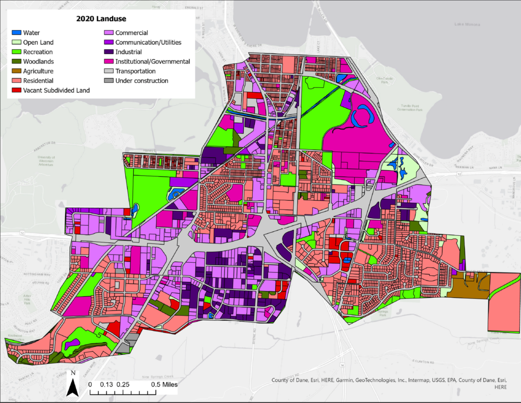
Madison South Side Land Use by Parcel
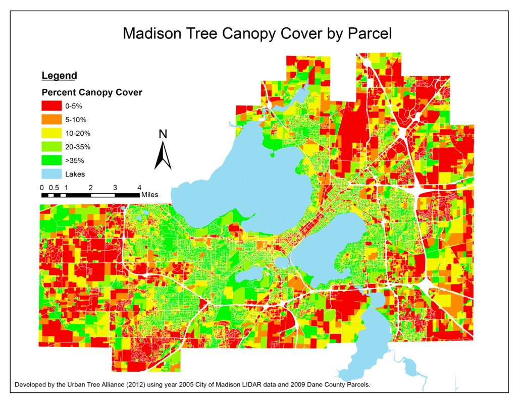
Madison Tree Canopy Cover by Parcel
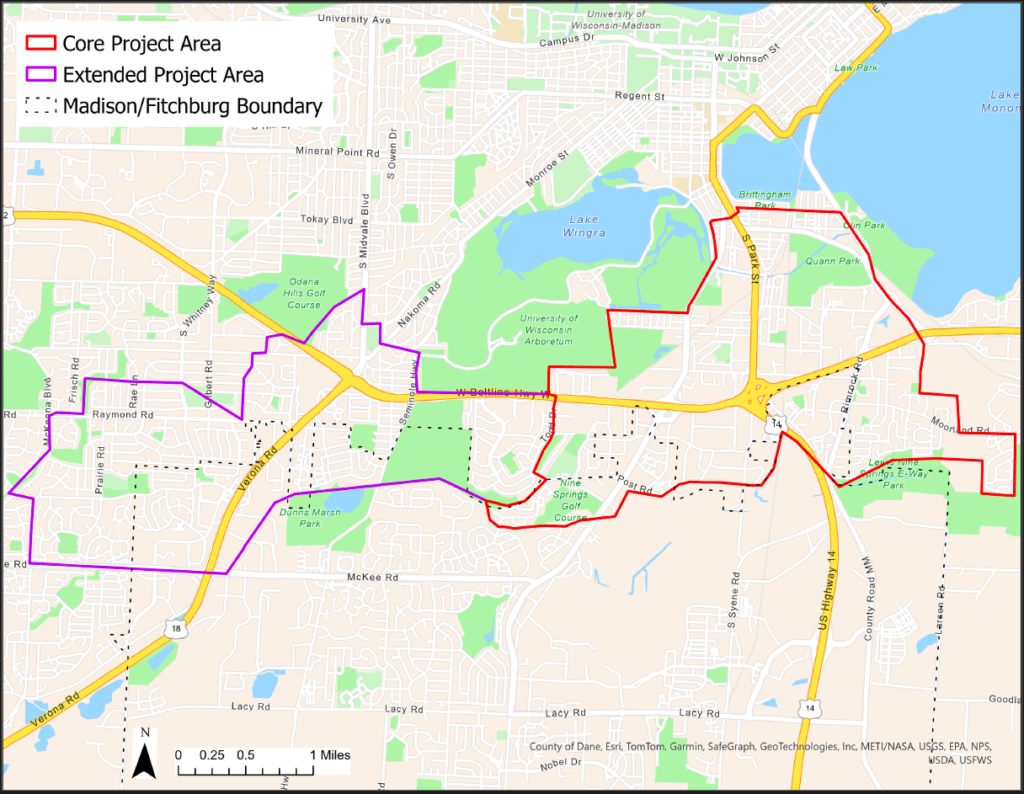
Madison South Side Community Forest Project Coverage Map
Atwood Tree Inventory Map
Urban Forest Canopy of Madison
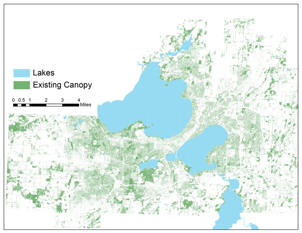
Madison Land Cover Map
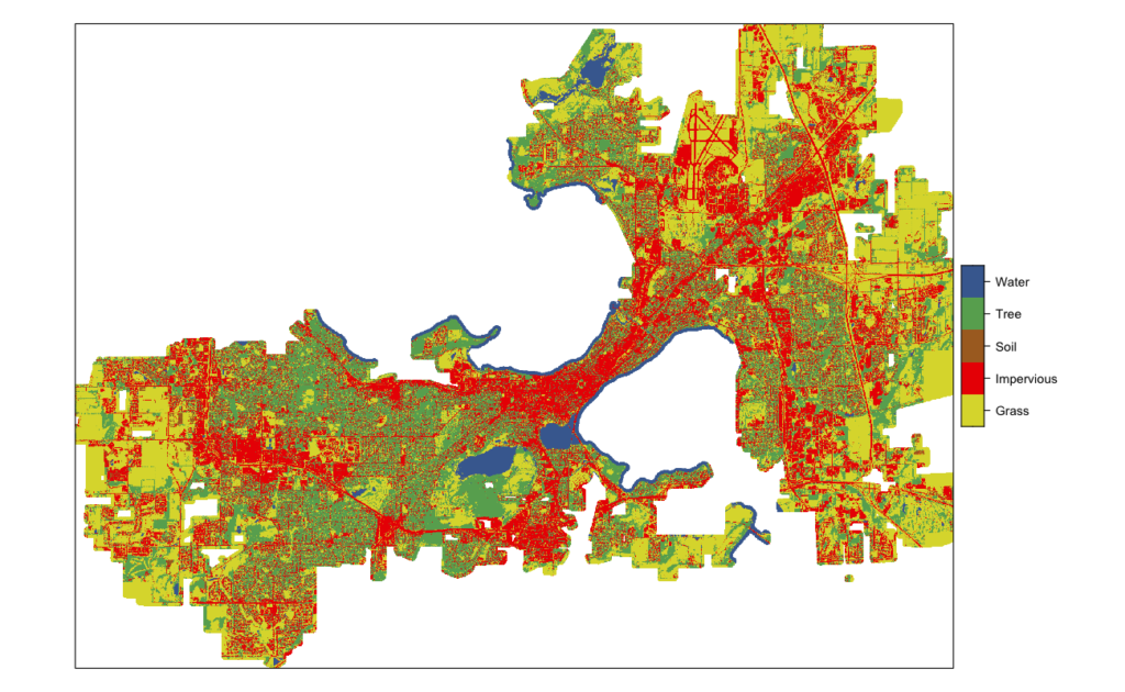
Madison Land Use by Parcel
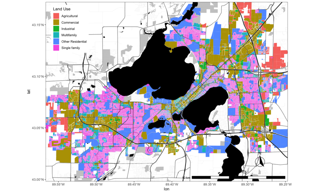
Madison South Side Land Use by Parcel
Madison Tree Canopy Cover by Parcel
Madison South Side Community Forest Project Coverage Map
Atwood Tree Inventory Map
Instructions:
Browse: Scroll around the map by clicking a location and dragging the map to move to another place.
Zoom: Use the (+) and (-) in the upper left hand corner of the map or double-click to zoom in.
Search: Type in an address in the upper right-hand corner to find your house (include “Madison, WI” in the address)
Select: Click on a dot to learn more about a specific tree
Change the background: Click on the “basemap” icon in the center of the header to change the background imagery. Other options show roads, building footprints, aerial images, etc.
View the Legend: Click on the legend to see what the map icons represent.
Attribute Data Formats:
This map is a combination of two data sets: (1) 5488 Trees inventoried on private property in the Atwood neighborhood and (2) 2590 street trees from the City of Madison’s street tree inventory. Depending on whether a tree is a street tree or a private tree, the data contained in the map will be in a different format.
The top image is an example of a private tree. The data fields include:
- FID: A number used for recording keeping.
- Genus: The scientific genus to which the tree belongs.
- Species: The second have of the scientific name.
- COM_Name: The common name used to identify the tree.
- DBH_Inch: The tree’s trunk diameter in inches “at breast height” (about 4 ft. from the ground)
- Ht_TP_FT: The height to the top of the tree in feet.
- HT_BT_FT: The height to the lowest branch on the tree in feet.
- CONTN: A rating of the trees health on a scale of 1-100.
- DIEBACK: The percent of the tree that is no longer living on a scale of 1-100.
The lower image is an example of a street tree’s information. Data fields include:
- Common_Nam: The common name used to identify the tree.
- FID: A number used for recording keeping.
- DIAMETER: The tree’s trunk diameter in inches “at breast height.”
- HCLASS: The height tree’s height broken up into 5 classes (1=0 ft., 2=1-15 ft., 3=15-30 ft., 4=30-60 ft., 5=60+ ft.)
- CONDRATE: A rating of the tree’s health on a scale of 0-1)
